Sunday, September 1, 2013

Tsodio Hills

Tables, chairs and lunch came along with us.
As I mentioned before, Catherine and Zabeta spent he day before I arrived in Johannesburg with Carl and Glenn discussing flight planning and sites along our route.  One of the things that they raved about was the Bushman paintings at Tsodilo Hills. It had been years since they'd been there, but they said that there was an airstrip that was only a couple of kilometres from the park and that the park itself was well worth seeing.  Not to be missed in fact.  So, when we were in Maun we did some investigating on the airstrip.  Our New Zealand friend Aman (remember the saint who gave us the map?), said that she'd been there, it was worth the trip but that she'd never landed at the airstrip and that she might not recommend it.  Since the park was only 50 kilometers from our lodge we decided to see if the lodge could arrange for a land-based tour.  And, of course they could.  (For a fairly reasonable additional fee.)  After some discussion we decided that we'd go see what these Bush paintings were all about.  Bright and early on May 23rd, we headed west toward the hills.

Because the lodge is located on an island, we first had a 10 minute boat ride, followed by a truck ride, first through the sand of the delta, then on a tar road, then on a gravel road, and finally through the last 5 kilometers into the park.  In all it took us a little over an hour and a half to make the (30 mile) trip.  (Very little happens quickly in Africa.)  We could have flown there in about 15 minutes, but as it turns out the airstrip was indeed in pretty bad repair.  The land option was really the best choice.

On the gravel road
Tsodilo Hills is made up of four hills: The highest, the "Male", the "Female," which is a little ways apart from the "Male" (apparently there was a divorce along the way - no joke, our guide said this) and the "Child," who stayed with the "Female" after the split.

The "Male"
Going up!
These hills house something like 4,500 rock paintings, dating back some 20,000 years, almost all of which were crafted by the San Bushman  people.  The paintings, being in the desert, are remarkably well preserved.  According to Wikipedia, this is one of the most historically-significant sites in the world.  And for that reason, it made the UNESCO World Heritage List.
There are so many paintings at the site, experts have speculated that not all of them have been discovered yet.  That said, many of the paintings are literally right next to the trail so all that you need to see them is some endurance (the path is steep), a good pair of walking shoes, and a lot of water (it's hot there).

At the recommendation of our guide, James,we chose the Rhino Trail, for it's variety of paintings and interesting views,which is on the flanks of the "Female" hill.


Sure enough less than 1/2 mile up the trail, the first of many paintings appeared.  What I found most remarkable about the paintings is not their quality (which is amazing given that they've been around for 20,000 years) or their artistic style (also impressive) but WHERE they are located.  Many of them are located very high on the rocks and without an obvious way to reach them.  The access would not be OSHA approved.


James


Here is the first painting that we encountered:


Can't see it?  Look carefully at about 8:00.  Here is a closeup:


We meandered up, around and over the Female Hill for about 2 hours, seeing an amazing variety of paintings.  Apparently, aside from the obvious artistic reasons, the paintings served as a way to communicate amongst the Bushman about what type of wildlife was in the vicinity.  I questioned whether Bushmen would ever see  he penguin depicted on one rock, until Tian told us that Cape Town has penguins.  Cape Town is a long way from central Botswana....apparently the San got around.  Here is a sampling of the various paintings.


Rhino, and Buffalo

Again, check out how difficult these places are to reach

Penguin and Whale

Elephant

This is a really famous collection of paintings, that is featured on Botswana currency.  More impressive is WHERE they put these!  Read on.


These paintings are about 200 feet up.  I'm glad that I didn't have to paint the Kudu or Giraffe here!


Apparently, there was more to the Bushman Billboard approach to communication than just indicating which animals inhabited the area.  They also wanted to report on events that they held at the site.  Sort of like Facebook, but without the need for Wifi.  Essentially the party section:

It's a little bit abstract, but imagine stick figure men dancing around, and you'll probably put two and two together....


We rounded out the hike by looking at the rock formations themselves, which are quite beautiful.  One is actually shaped like the African continent:


During the hike, James and Adam taught us how to eat the marula fruit, which is the basis for a liqueur very similar in flavor to Baileys called Amarula.  The fruit itself is intoxicating, so it's pretty common to see animals get drunk after eating it.  (No joke. Here is proof.)

We didn't get drunk from it, but it is good, if a little bit difficult to eat.  It would take some time to consume enough of them to feel tipsy as you first have to soften them up then you split them open and finally you drink the juice.


After the hike, we had a lovely lunch at the park entrance and then made the long trip back to the lodge.  Along the way we encountered several livestock who didn't want to make way for us off of their road.  We also gave a ride to some folks on their way to town for a funeral.
OK...they were there first, but it is a road...

Typical ranch house

When we arrived back at the boat Adam promised us that he'd show us his favorite hippopotamus watering hole.  We'd heard the hippo chuffing about the night before but hadn't yet seen one.  He said that we were assured to see one in his little hiding spot.  We did.  In fact there were nine of them in the pool.  We were able to get within about 300 meters of them, which was plenty close enough.

I used a really long telephoto lens on this shot and then cropped it.  We were a safe distance away.


We then made our way back to the lodge, seeing more bird life (and no crocodiles).  The next morning we were scheduled to head for the Chobe.  Located at the northern edge of the Okavango Delta, it's known for its elephant population.  For the moment though, we enjoyed where we were, amongst the people, the birds and papyrus of the delta.  It was a really good day.

Fish Eagle pair looking for dinner.


Sunday, August 25, 2013

The Delta


I have wanted to see the Okavango Delta for over 20 years.  This wish began the last time I visited Africa, only at that time, I was in Central Africa, where I saw silver back mountain gorillas, which inhabit the mountains of the Congo.  (Think Diane Fossey).  I met some Australians on that trip, who described their experience seeing elephants in the Delta.  It was magical and was literally something that I have dream about. Seeing the Delta has been on my bucket list ever since.  
Adam
The Delta is an amazing place. According to Wikipedia every year, 11 cubic kilometres (11,000,000,000,000 liters!) of water flow into the delta. It's quite difficult to get your head around what that means. It's a heck of a lot of water, and while it does spread over something like a 15,000 square kilometer area, all of that water literally disappears - is used by plants, evaporates, and makes its way into a huge aquifer. It's gone long before the continent reaches the ocean.  This is why we could fly for less than two hours and go from desert to water land.

Beware the monkeys!
After landing on our second remote airstrip (although this was our first that had cattle as a possible navigation aid), we were swept away to the lodge by Adam, who was to be our guide for the next 2 days.  The world lights up when Adam smiles.  He is particularly passionate about birding and never went anywhere without his bird book.  We were bird novices and he was quite patient with us as he showed us the beautiful birds who made the delta their home.

Our home was to be the Nxamaseri Island Lodge.  We practiced for a very long time trying to say Nxamaseri - it is essentially click + "n" + amaseri.  Timing is important in the pronunciation.  I don't think that I ever actually got it right.  

Each cabin had it's own deck, along with a lovely
tree-lined view of the delta.  It was magic.
We didn't know it before we arrived, but we timed our stay perfectly.  The lodge was just about to do some remodeling, so they were not taking any long term visitors, which meant that we were the only ones there.   We each had our own cabin, which had an open half wall facing the delta.  From our beds we would hear the hippos chuffing around as the sun set and the monkeys getting breakfast as the sun rose.  You had to be careful about the monkeys, as they considered the rooms their own.  Anything not tied down or put away was sure to be a target for their (monkey) business.  

After settling in, the proprietor, Tian (another chap from South Africa) suggested that we go on a sundowner cruise.  We took full advantage of that offer and scrambled into the skiff, arms full of gin, and snacks. Catherine was our mixologist.  We treated Adam to olives (beware the pits), peanuts, and dried fruit.  He was quite willing to try all of these new flavors as he educated us on the various birds and plants of the delta.

Papyrus
This wonderful water world supports a broad range of life: fish (sport fishers flock here - we took a pass on that option) reeds, papyrus, hippos, crocodiles and birds.  The water has a high amount of minerals in it, which means that not much in the way of nutrients go to the surrounding land.  That said, Delta water served as our drinking  water  (after filtering and boiling). It was sweet and tasty.  And, those that live in it seem to thrive.

The bird life was beautiful, and with Adam's help we learned to identify many and better appreciate them all.  There were Jakanas, Darters, Bee Eaters, Fish Eagle, Kingfishers, and Egrets.  There is also a very rare species of owl that we didn't see.  Here are a few that I was able to capture:


Bee Eater

Fish Eagle


Fish Eagle on the hunt
Egret
Kingfisher


As we meandered through the Delta in the late afternoon light, G&T's in hand, the day came to an end and the light just kept getting better and better, going from this:


to this:

and finally this:

It took our breath away.  As Tian said, you really cannot capture the magic of an African sunset with a picture.  You'll have to take my word for it that it was FAR better than it looks!

And so, that was the end of our 4th full day in Africa.  We had started the day in the middle of the Kalahari desert and ended listening to the hippos wake up for their nightly foraging.  (Go here and listen hippo sound #2 for an example!)

We drifted off to this lovely sound, in this really peaceful place.  The next day we were going inland to see 20,0000 year old Bushman paintings.  And, when we woke up, we knew that the day was going to be great.    I will tell you all about it later, but here is how we started:


Friday, August 2, 2013

From Dust to Rust

On the morning of May 22nd, we got up early to head north.  As you can see from the map, we left the northern part of the Kalahari Desert, stopping in Maun for fuel, and then on to Nxamaseri Lodge in the heart of the Okavango Delta .  Traveling from desert to delta, our world was about to change, literally under our feet.

Catherine made it a habit to do her flight planning between sundowners and dinner.  On the night of the 21st, she was muttering to herself (and maybe to us) that she left one of her maps in the plane.  She seemed almost apologetic about it.  At the time that seemed strange to me.  We knew where we were going.  Our visual reckoning over the Central Kalahari was pretty darn good (and that was with almost no landmarks) and I knew that as we flew north there would be many more recognizable way points.  What was there to be guilty about?

Dixie looks like a wee little plane
amongst all of the Caravans
Catherine and Aman, (our Map Angel) filing flight plans.  
As it turned out, there was maybe just a small thing or two to be concerned.  The pilot's job is good flight prep to ensure safe flights.  Before I arrived, the folks at Sky Africa drilled Catherine with flight plans and details and gave her all of the maps for the journey...except for one:  The trip from Maun to Nxamaeri.  Catherine's job was to be sure that she had all of the information in hand and organized.  In the massive information download, this one (and only this one) was missed.  And, she only discovered the missing item when we returned to the plane that morning, which was a tad too late to do anything about it.  The good news was that we had a short flight to Maun, which is a large regional airport, and we would surely find a map there.

So, after saying goodbye to our new friends in Deception Valley, we headed back to Dixie.  By this time we were getting pretty good at packing, pre-flight checks and giving Catherine some quiet time before take-off.  Similar to many other things in life (bike racing and boating included) when piloting a small plane, there is always a necessary pre-departure bio-break.  Maybe too much information, but, I found the parallels interesting.  It must be some throw-back to how we managed effective hunting in days gone by....or not.

A pretty typical airport Flight Ops Office
Anyway, with wheels off the ground by 8:00(ish), we headed for north for the short flight to Maun.  On our approach, it became clear that Maun is a big transit point for lots of air traffic.  The airwaves were busy with instructions from the control tower, which again, was managed by a woman.  The voices from the pilots, however, were mainly men, with the exception of one voice.

After two days in the bush, the bustle of a busy airport was a little bit overwhelming.  Despite that we had re-fueling down pat and managed not to give anyone a heart attack by offering payment in plastic.  We were then instructed to park at the end of a long line of planes and make our way into the building (again without any accompanying security personnel) to pay landing charges and file flight plans.  On our way across the tarmac, we were greeted by a tall, beautiful, New Zealand woman named Aman.  She had a stride that was at least twice ours, making us run to keep up with her.  She was instantly curious about the three middle aged women shuffling across the airfield.  As it turns out, she'd heard Catherine on the airwaves and sought us out because female pilots are not a dime a dozen in that part of the world.  (Or, maybe anywhere for that matter.)  Once she found out what we were up to, she tried to talk her way into the group.  While that might have been fun, she was really tall and would have put a major dent in our ability to carry alcohol, so instead of offering up our only empty seat, Catherine started asking questions:  Can you land at Tsodilo Hills?  What is the airstrip like at Nxamaseri?  Do you have the latest weather?  And, most importantly, do you happen to have a spare map?  As luck would have it, she didn't but was able to get us one...not a great one, but a well-loved, well used, coffee-stained map.  It was ours to keep and it was perfect.
No mirage here!

Map in hand, flight plans logged, re-fueling complete and yet another security point behind us (all of which was becoming at least familiar, if not old hat) we headed back to Dixie for the 30 minute flight north to Nxamaseri.

We had done enough advance reading to understand that we were about to see a big change in scenery.  Knowing and seeing, however, are two very different things.  In the course of about 20 miles the pans that we'd been seeing for 100 miles went from bone dry to true ponds.  Yes, you could still see salt on the sides, but there was real water, in them, not a mirage.  As we journeyed further north, the pans started to disappear and we began to clearly see rivers.  All of a sudden it felt like we might need life jackets in the unlikely event of a water landing.What a difference a few miles make!

It's so amazing, it needs to be in the blog twice.
Carl told Catherine and Zabeta that we should be on the lookout for the cloverleaf.  That is was a  very famous part of the Okavango Delta and when we got there, we'd know.  Turns out the cloverleaf looks a lot more like Casper the Ghost (with only one eye...maybe he's in profile?) than a cloverleaf...in any case, Carl was  right, it is quite recognizable and really amazing from the air.

No Bovine or wind here.
From that point, we had our dead reckoning fix and we knew that Nxamaseri was nearby.

We'd been warned not to land at the short airstrip until we had verbal confirmation from the lodge.  Apparently the grass strip doubles as pastureland, so in order not to have an unfortunate bovine encounter on landing, the lodge crew clears the runway prior to all arrivals.

This seemed like a prudent course, so we duly called in and confirmed a clear runway.  Then, using our belt and suspenders caution, we buzzed the runway twice to ensure that no stray cattle were missed in the clearing process.  With that confirmed, and wind direction from the sock (none) identified we proceeded to land.

Watch your feet....those mounds are not mole hills!
It was only after taxing, securing the aircraft (being careful to avoid cow pies) and hauling our luggage across the strip, did we realize that we were on an island.  Our transfer to the lodge was via boat, and the lodge itself was on another island.  This couldn't be any more different from Deception Valley if we tried to make it so.

As we picked our way past the cow pies and looked out into our new world, we were overcome with water....lush and wet and beautiful.


We weren't sure what would be in store for us, but we knew it would be good.  And so our adventure and wonder continued!
No dust here.

Monday, July 29, 2013

The Bushmen

Jacu giving some perspective on paw prints
So, I know that I'm going about this rather slowly...and you may be wondering what day we're on, exactly and maybe when this might finish.  Well, hunker down, because this is going to take a while.  So far, I've only told you about three landings and two hotels/lodges, which gets us exactly to May 21st.  (I arrived in South Africa on the 19th, so it's STILL really early in the trip.  I like to tell stories....have you figured that out yet?)  As I mentioned before, we had a couple of big treats on the afternoon of the 21st.

No quills on this one....
Kay-ha (left) and Chote
First, we went on a bush walk during the middle of the day.  I didn't take my camera, so I can't show you any pictures of that experience.  Animals with any sense at all were sleeping.  Having no sense, us humans were out and about, quite safe, not  encountering any wildlife (except for birds).  We did see lots and lots of animal tracks though.  As I mentioned, the dust in this part of the world is really fine, which makes for great tracking.  So, we learned a lot about how animals behave, by looking at their footprints.  It was really interesting and we learned a lot....like how not to approach a warthog hole in order to avoid  trampling, should you accidently interrupt their slumber.  We also learned that warthogs always back down their holes, so that they can exit quickly.  Warthogs and porcupines, being of opposite sleep cycles, generally hot bunk in in the same quarters.  Warthogs at night, porcupines during the day. So, it's not uncommon for an early-to bed warthog to have an untimely meeting with a late to rise porcupine, resulting in an unfortunate deposit of porcupine quills in its backside.  We were curious about porcupines.  The Swiss couple travelling with us ordered one up to see before we left, under the theory that they already had lion cubs and leopard solidly on the "seen that" list.  A porcupine ought to be easy, right?!

While Jacu said, they aim to please, he gave no promises for a porcupine spotting.  He then distracted us with a giraffe footprint.  (Way to deploy the "look over here" tactic, heh?)  We were hot and stupid and took the bait.....
Kay-ha Making arrows

The ~3 kilometer walk, which lasted about an hour in the noon sun, was amazing.  And, I genuinely thought that it would be the highlight of the stay.  Au contraire.  We had a very special treat ahead of us.  On the first day, Jacu mentioned that we would be seeing a cultural reenactment of the Bush people. Here is how it is described on their website:

Chote showing his impala backpack.
You should see the stitching on this thing.
Guided walks with the Bushmen to explore their culture, survival and hunting skills and their extraordinary knowledge of the veldt and animal life.  

My first reaction was that we were going to see something like a fire dance at a Hawaiian Luau.  Nice enough, and maybe fun, but not my thing...I was wrong.

A dung giraffe - made from acacia thorns.
This might not pass the child-safe test these days,
but whole generations survived playing with things like this.

As I mentioned earlier, the Bushman ceased having a nomadic life about 30 years ago when the Botswana government (after discovering its vast wealth of diamonds) started funding medical care and education for all of its citizens.  This then took the nomadic Bushmen from the desert to villages and put their children in schools.  Aside from their rock paintings (more on that later), the
Bushmen had no written record.  Their way of life, for right or wrong, changed forever, when they moved to villages.  So, what was once known is now at big risk of being lost.  (Read Tolkien to find out how bad that can be...)

The folks at Deception Valley employ Bush people on their staff, both as tracker/ guides and as house staff.  Seeing that this history was in real jeopardy, they encouraged their guides to talk to their grandparents and learn as much as they could about their life as young people 50 or more years ago.

Jacu translating the finer points of
harvesting poison, for arrow tips.
Kay-ha demonstrating how to take down an Eland with
 a small, but deadly, poisoned arrow.
Our walk with Chote (Cho-tay) and Kay-ha was the result of this exploration.  The walk, which was conducted all in the clicking language of the Khoisan, started around 4:00 in the afternoon and went for a couple of hours.  When necessary, Jacu translated for us.  But for the most part, we understood what they were talking about as they demonstrated how they made their tools, harvested poison from certain plants for their arrows, made toys for their kids, extracted water from tubers for drinking, made beer and snared birds.  What follows are pictures from that really special experience.


Catherine holding up a finely-crafted multi-use stick.
Could be for walking or beating....


Snaring a duck - disregard the fake bird.


At the end of the walk we arrived at a couple of huts, which showed how they slept and lived.  As a precaution Chote and Kay-Ha checked inside for animals sleeping.  While describing what they were doing in Khoisan, mid-sentence they both stopped, and started laughing.  We said "what?!"  In perfect English Kay-Ha pointed inside the hut and said "Porcupine!"

Anyone home?  Only us porcupine!


What ensued was a little gentle encouragement from Chote and Kay-Ha for the porcupine to wake up and get on with his night by exiting the hut.


During our mid-day jaunt, Jacu instructed us, in a very stern manner, not to EVER scream or to run when surprised by something in the bush.  Even though we were prepared for the emergence of Mr. Porcupine, the sight of the him bolting from the hut resulted in both screaming and running....and not necessarily from just the porcupine.  

That said, the Swiss people were quite happy in having their wish granted and were quickly coming up with more asks....

On the run...no screaming allowed.

Getting themselves back to their presentation, Chote and Kay-Ha then demonstrated how to make fire, using two sticks and some brush.  Friction really does work.........


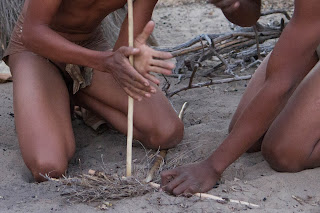
Within about 10 minutes they had a substantial fire going, after which Kay-Ha performed a medicine man dance.


Small doll to ward off bad stuff.
He dances like a puppet, only you use your toes
to control the action.

Preparing for the medicine man dance.

The medicine man dance.


I am guessing that Chote and Kay-Ha were in their early to mid-20's.  They researched and prepared for the demonstration completely on their own.  They made the clothing and tools that they used, and they preformed it in the clothing that was worn when their people were nomads, which as you can see, isn't much.  By the time the sun went down, it was really cold out there.  I am guessing that it was in the mix-50's. (It should be no surprise to anyone that knows me that I was in my down parka, despite the fire.)  By the time they got done, they were probably really cold.  We wouldn't have known if they left anything out, but they didn't stop until they got to the end, which was the dance.  It was really clear to me that they were proud of these traditions and really liked being able to pass it on to people who didn't know about them.  It was an amazing last evening in Deception Valley and something that I will never forget.

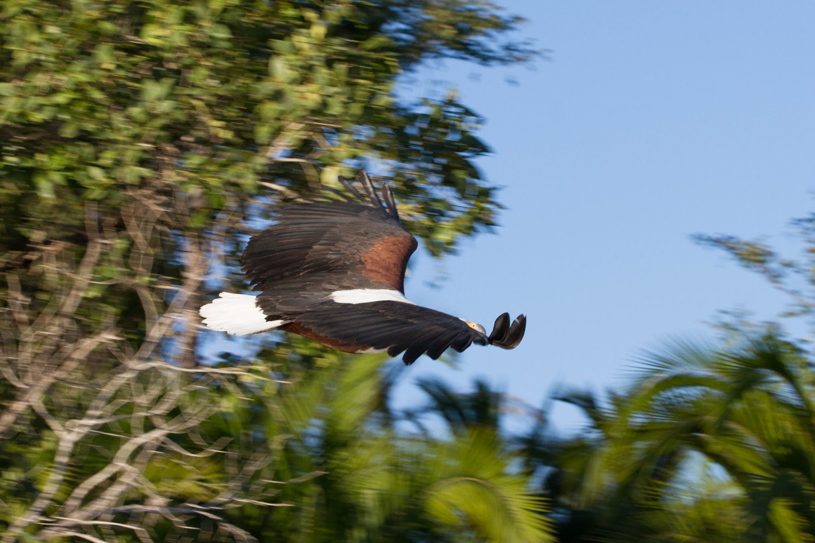
As I mentioned, this was still early in the trip and we had much to see ahead of us.  We really wanted to stay, but it was time for us to move on.  We left early the next morning, leaving behind the dust of the Kalahari, and headed for the water world of the Okavango Delta.  Here is a sneak preview of what is ahead.  I think that it will be worth hanging around for!

No dust here!